


Moving is a massive upheaval, right? For parents, though, it’s not just about packing boxes and changing addresses; it’s about one thing above all: safety. You’re choosing a new world for your kids, and the anxiety about sending them to a new school alone—walking, biking, or even catching the bus—is real. We’ve all been there, squinting at those static, flattering photos from a distance and those frustrating flat satellite maps. They show you a house, but they never show you the reality of the neighborhood.
They fail when you need to answer the crucial safety questions: Is that intersection truly dangerous? Is there a hidden drainage ditch right off the sidewalk? How can I honestly feel secure if I haven’t seen the whole picture? Relying on limited tools is an enormous gamble. This is precisely why embracing modern 3D aerial renderings is so vital. By utilizing professional aerial rendering services, you gain a comprehensive, visual medium for an efficient safety assessment, offering a profound sense of certainty. This sophisticated technology, which provides 3D aerial renderings, has become an indispensable tool for securing genuine peace of mind before you leap.
Mapping the Safety Perimeter: Beyond the Street Level
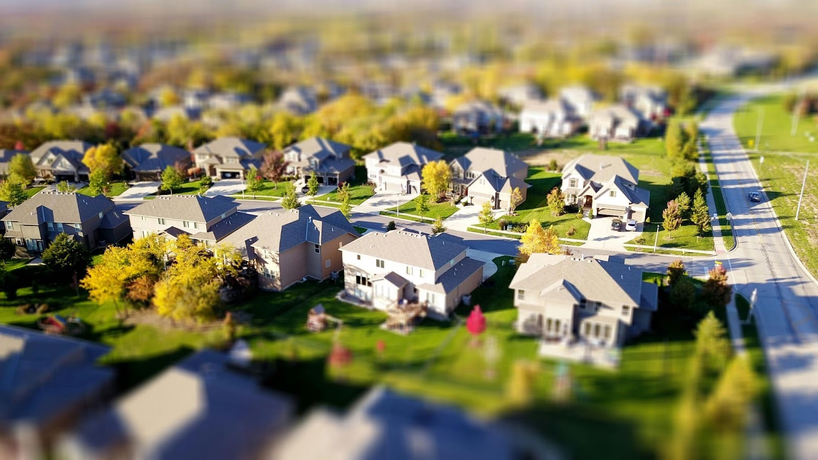
What are we talking about when we discuss 3D aerial renderings? Forget those grainy, flat images where everything looks like a pancake. These are photorealistic, high-resolution visualizations, often built from drone data or specialized geospatial surveys, that give you a dynamic, true-bird’s-eye perspective of the entire community with accurate scale and elevation. Think of it like suddenly having the ability to fly—you become the ultimate neighborhood scout. The fundamental value for you as a parent is the unobstructed view of the surrounding environment that no ground-level photo or casual drive-by could ever provide.
This allows you to spot major infrastructural or geographical hazards instantly. Are there hidden high-voltage lines running near the park? Is that “private road” actually a busy, unlit access point behind the subdivision? These are serious, practical risks that are completely invisible from the street, but which an aerial 3d rendering instantly brings into sharp focus. This involves seeing both the forest and the trees simultaneously to conduct a thorough, preemptive risk assessment.
Assessing Traffic Flow and High-Risk Zones
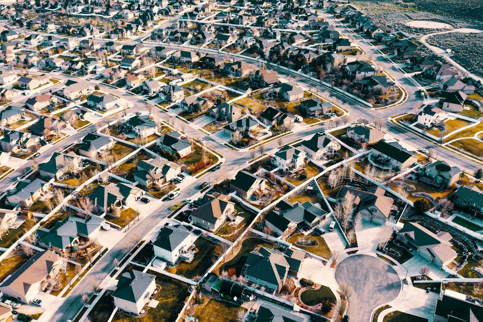
Once you have this elevated perspective, you are no longer passively viewing the neighborhood; you are performing a strategic security audit. Using the detailed 3d architectural aerial renderings, parents can expertly analyze traffic patterns near their potential home and the local school. You can visually differentiate between a quiet suburban side street and a bustling arterial thoroughfare that carries heavy traffic and high speeds. Your mission is to spot the high-risk points: those confusing or poorly designed intersections that lack visible crosswalks or clear traffic signals.
You can pinpoint precisely where dense foliage, tall commercial fences, or the sheer bulk of buildings create significant blind corners or visibility hazards for both drivers and children. It is absolutely crucial to gauge the speed and sheer volume of vehicle movement your child would encounter daily, and an aerial view rendering delivers this objective truth. By identifying these potentially unsafe crossings and high-speed roads, you can develop a realistic mitigation plan before you ever decide to move.
The Commute Confidence: Visualizing the School Run
For every family, the daily journey to school—the infamous school run—is where all the logistics and security concerns coalesce. This is where 3d aerial views transition from being a neat visualization to a functional safety blueprint. It allows you to mentally “walk” or “bike” the entire distance your child will travel, meticulously assessing the security and logistical efficiency of that path. Will the route feel secure and inviting, or will it funnel into low-visibility areas or congested zones of parked commercial vehicles?
You can check for unofficial shortcuts—known as desire paths—that might be quicker but far less safe and visible. This comprehensive overview is essential for choosing the most secure, least-congested route or confirming that the designated bus stop is accessible and safe from major traffic bottlenecks. You achieve commute confidence because the aerial view rendering lets you plan with certainty, removing the dangerous guesswork inherent in flat 2D navigation.
Identifying Practical Obstacles and Safe Havens
What are the gritty, day-to-day realities of the route your child would take? The detail provided by aerial 3D renders is truly granular, allowing you to identify the physical barriers that pose an everyday risk instantly. You can spot exactly where a sidewalk suddenly vanishes, forcing a child into the road, or locate persistent construction zones that might create hazardous detours for extended periods. Even more importantly, a responsible parent must know where the designated safe havens are—the obvious public spots where a child could retreat if they felt threatened or were injured. This visual data is utterly indispensable for high-stakes risk planning. This tool helps you identify the following practical realities:
- Lack of Sidewalk Continuity: Spotting sections where the walking path forces pedestrians into the vehicle lane.
- Significant Construction Activity: Pinpointing sites where temporary hazards or unpredictable detours are likely to occur.
- Visible Security Points: Locating highly visible public buildings, police stations, or bustling retail businesses that can serve as safe havens for a child in distress.
- Physical Barriers and Hazards: Identifying steep drop-offs, deep drainage areas, or thick, unmonitored wooded areas immediately bordering the planned route.
The Power of Perspective in Decision-Making
Ultimately, the best reason to invest in a detailed aerial render isn’t just about micro-managing safety; it’s about the massive psychological and financial assurance you gain during one of life’s most significant decisions. This visual certainty significantly reduces parental anxiety by allowing you to move past hoping for the best and into calculated certainty. You’ve seen the neighborhood, you’ve assessed the risk using the unparalleled clarity of an aerial 3d render, and you can now make a decision based on objective data, not just emotional appeal.
Furthermore, this tool helps prevent a costly, agonizing mistake: imagine relocating your entire family only to discover that the neighborhood’s layout or the specific school commute is fundamentally unsafe or hopelessly unworkable. That kind of error can be devastating. Finally, the tool enables clearer, more confident collaboration. It’s infinitely easier to plan and discuss the safest path to school with a spouse, or even with the children themselves, when everyone is looking at the same, definitive 3D aerial view rendering visualization.
Conclusion
We know that parental anxiety around family relocation and child safety is a legitimate, pervasive challenge. Static 2D maps and filtered property photos are obsolete relics for this critical task. The professional adoption of 3d aerial rendering is fundamentally transforming neighborhood research from a stressful, abstract guessing game into a calculated, safety-first assessment.
These powerful tools, offering crystal-clear aerial view renderings, empower parents to identify high-risk zones, map secure commuting paths, and pinpoint safe havens with a level of confidence that was simply impossible to achieve a decade ago. For any parent prioritizing their child’s daily well-being and the seamless logistics of their new life, utilizing these comprehensive, elevated 3d aerial renders is the ultimate, non-negotiable step to gain peace of mind and truly ensure the long-term safety of their family’s new beginning.


comments +